Back to the librarykm 3–4km 5–6km 6–8km 9–10km 10–10km 11–12km 14–15km 15–16km 16–25km 26–27km 28–29km 30–33km 49–51
GravelMade by RouteCasterRound trip
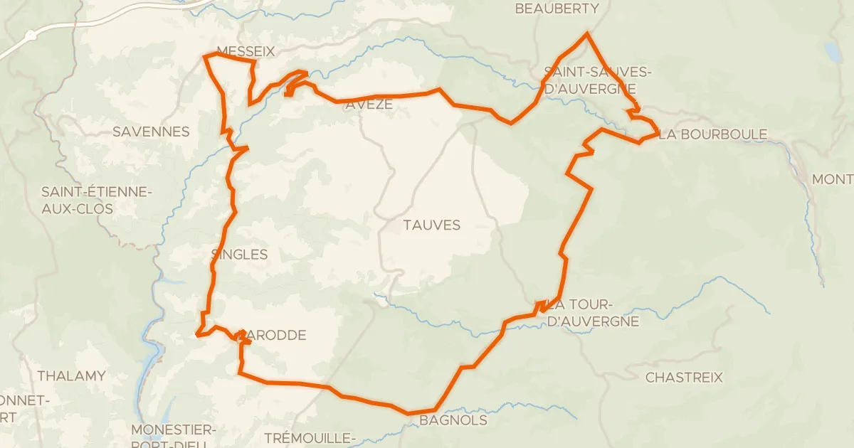
Langs La Dordogne en La Rhue
Distance
63 km
Ascent
1,322 m
Highest point
945 m
43% paved
Start from your location
Ride there from home: we find the shortest way to the loop and start the loop from there.
The ride
This loop sets off from Bort-les-Orgues and soon follows the Dordogne river, then the Rhue, before climbing into the Parc naturel régional des Volcans d'Auvergne. With 1322 m of elevation gain packed into the route, the riding keeps you honest, and the mix of paved and unpaved stretches adds variety underfoot. On the way back you pass the Gabacut river before rolling into Bort-les-Orgues again.
Climbs
Climb 1Hill
1.5 km at 3.8% · max 18.7%
Climb 2Hill
1.1 km at 6.6% · max 23.5%
Climb 3Hill
1.9 km at 3.6% · max 10%
Climb 4Hill
0.4 km at 8.3% · max 36%
Climb 5Hill
0.4 km at 8.5% · max 14.8%
Climb 6Hill
1 km at 5.7% · max 16%
Climb 7Hill
1.1 km at 4.4% · max 18.6%
Climb 8Hill
1 km at 4.9% · max 16.7%
Climb 9Cat. 2
8.9 km at 3.8% · max 23.8%
Climb 10Hill
0.5 km at 5% · max 7.6%
Climb 11Hill
0.5 km at 11.5% · max 17.3%
Climb 12Cat. 4
2.9 km at 5.5% · max 19.3%
Climb 13Cat. 4
2.1 km at 6.5% · max 22.1%
Routes nearby

Road bike100% paved
Rondje Château de La Ganne en La Dordogne
78 km↑ 1,605 m8 km away

Road bike100% paved
Langs La Rhue en La Véronne
72 km↑ 1,440 m11 km away

Road bike98% paved
Rondje La Triouzoune en La Diège
74 km↑ 1,081 m15 km away

Road bike100% paved
Rondje Château de Montbrun en La Dordogne
75 km↑ 1,513 m16 km away

Gravel46% paved
Rondje La Sumène en Le Marilhou
60 km↑ 1,490 m17 km away
Road bike99% paved
Les gorges d'Avèze - Cyclo
76 km↑ 1,632 m21 km away
Col de la Sœur