Back to the librarykm 0–1km 3–6km 6–15km 18–19km 31–32km 33–34km 37–41km 52–59
GravelMade by RouteCasterRound trip
Rondje La Sumène en Le Marilhou
Distance
60 km
Ascent
1,490 m
Highest point
1,250 m
46% paved
Start from your location
Ride there from home: we find the shortest way to the loop and start the loop from there.
The ride
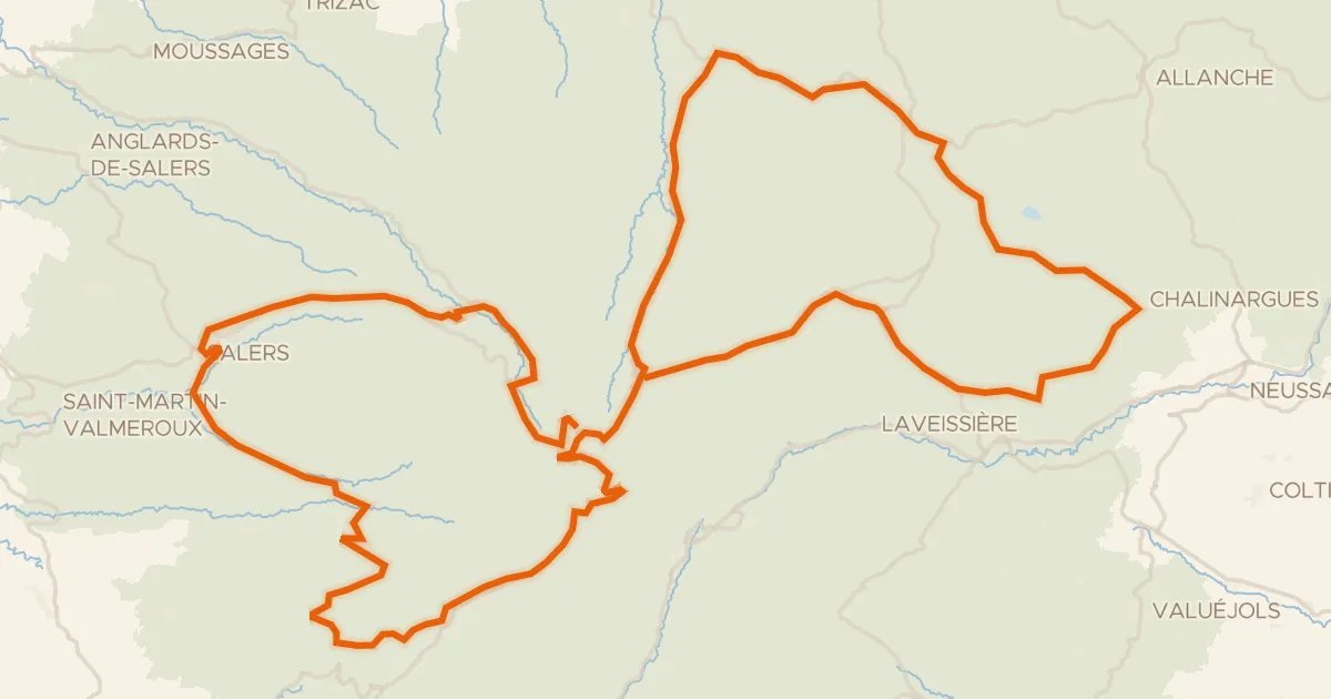
Roll out of Moussages and let the ride unfold: 59.6 km with 1490 m of climbing, split between paved and unpaved surfaces. You pass the river Le Marilhou, then head into the Parc naturel régional des Volcans d'Auvergne. Further on comes the river La Sumène, and from there the route brings you back to Moussages where you started.
Climbs
Climb 1Hill
0.4 km at 6.9% · max 9.4%
Climb 2Cat. 3
2.4 km at 7.8% · max 40.8%
Climb 3Cat. 2
8.9 km at 4.2% · max 11.8%
Climb 4Hill
1.1 km at 5.9% · max 10%
Climb 5Cat. 4
1.3 km at 7.5% · max 19.9%
Climb 6Cat. 4
1.1 km at 9.8% · max 26.5%
Climb 7Cat. 3
3.5 km at 7.5% · max 28.3%
Climb 8Cat. 3
7.3 km at 4% · max 21.1%
Routes nearby

Road bike100% paved
Rondje Château de Montbrun en La Dordogne
75 km↑ 1,513 m9 km away

Gravel35% paved
Langs La Véronne en La Sumène
60 km↑ 1,765 m14 km away

Road bike100% paved
Langs La Rhue en La Véronne
72 km↑ 1,440 m17 km away

Road bike100% paved
Rondje Maison du Bailliage en Château de Lamargé
70 km↑ 1,970 m19 km away

Gravel43% paved
Langs La Dordogne en La Rhue
63 km↑ 1,322 m21 km away
Road bike100% paved
RBX Boucle Volcan du Cantal
139 km↑ 3,272 m22 km away
Col de Bruel · Col de Néronne