Back to the librarykm 0–1km 3–13km 24–26km 43–45km 54–55km 55–60km 61–65km 79–80
Road bikeMade by RouteCasterRound trip
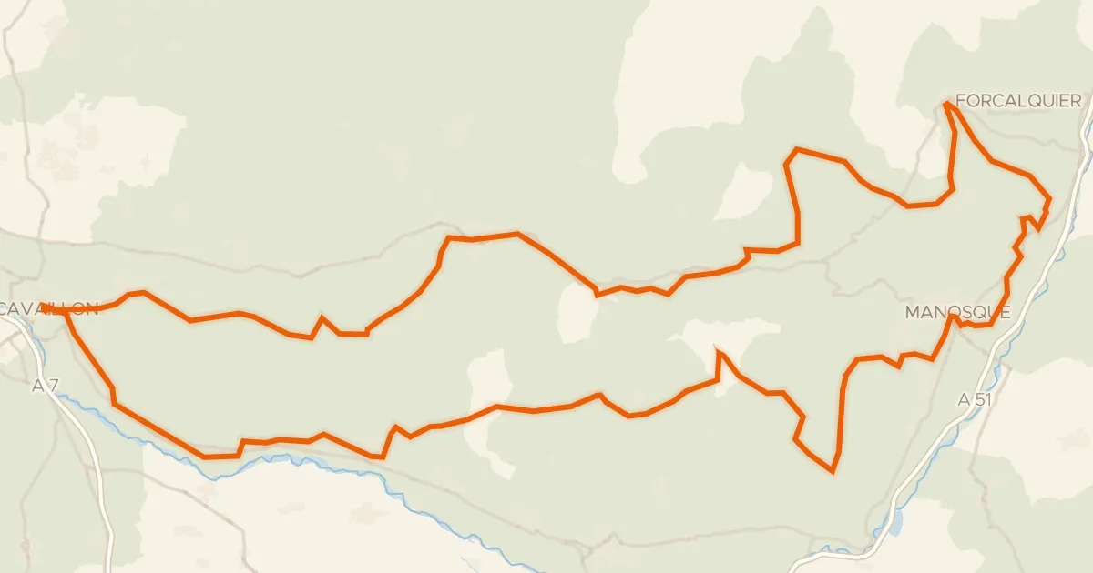
Rondje Parc naturel régional du Luberon
Distance
80 km
Ascent
1,377 m
Highest point
729 m
100% paved
Start from your location
Ride there from home: we find the shortest way to the loop and start the loop from there.
The ride
Roll out of Céreste-en-Luberon and the climbing begins, with 1377 m of elevation gain waiting across the route. You pass the river L'Encrême, then ride through the Parc naturel régional du Luberon before meeting the La Laye and later the Le Largue. The 79.6 km loop is almost entirely paved, and it brings you back to the village where you started.
Climbs
Climb 1Hill
1.1 km at 4.1% · max 6.3%
Climb 2Cat. 2
10.3 km at 3.2% · max 15.3%
Climb 3Cat. 4
1.6 km at 5% · max 11.9%
Climb 4Cat. 4
2.2 km at 5.6% · max 10.8%
Climb 5Hill
0.7 km at 4.1% · max 7%
Climb 6Cat. 3
4.8 km at 3.5% · max 14%
Climb 7Cat. 4
3.7 km at 4.2% · max 21%
Climb 8Hill
0.6 km at 4.9% · max 7.4%
Routes nearby

Road bike100% paved
Rondje Château du Grand-Pré en L'Encrême
75 km↑ 1,510 m8 km away
Road bike99% paved
Autour du Luberon à vélo (itinéraire orange)
238 km↑ 3,587 m11 km away

Gravel15% paved
Langs de L'Èze en Étang de la Bonde
58 km↑ 1,314 m11 km away

Gravel20% paved
Rondje Château Sainte-Marguerite en Le Largue
65 km↑ 1,499 m14 km away

Road bike100% paved
Rondje La Laye en Le Largue
76 km↑ 1,186 m18 km away

Road bike100% paved
Rondje Château d'Ansouis en Château de la Tour-d'Aigues
77 km↑ 795 m19 km away