Back to the librarykm 0–1km 1–2km 24–26km 26–27km 32–33km 34–35km 38–38km 41–41km 43–43
GravelMade by RouteCasterRound trip
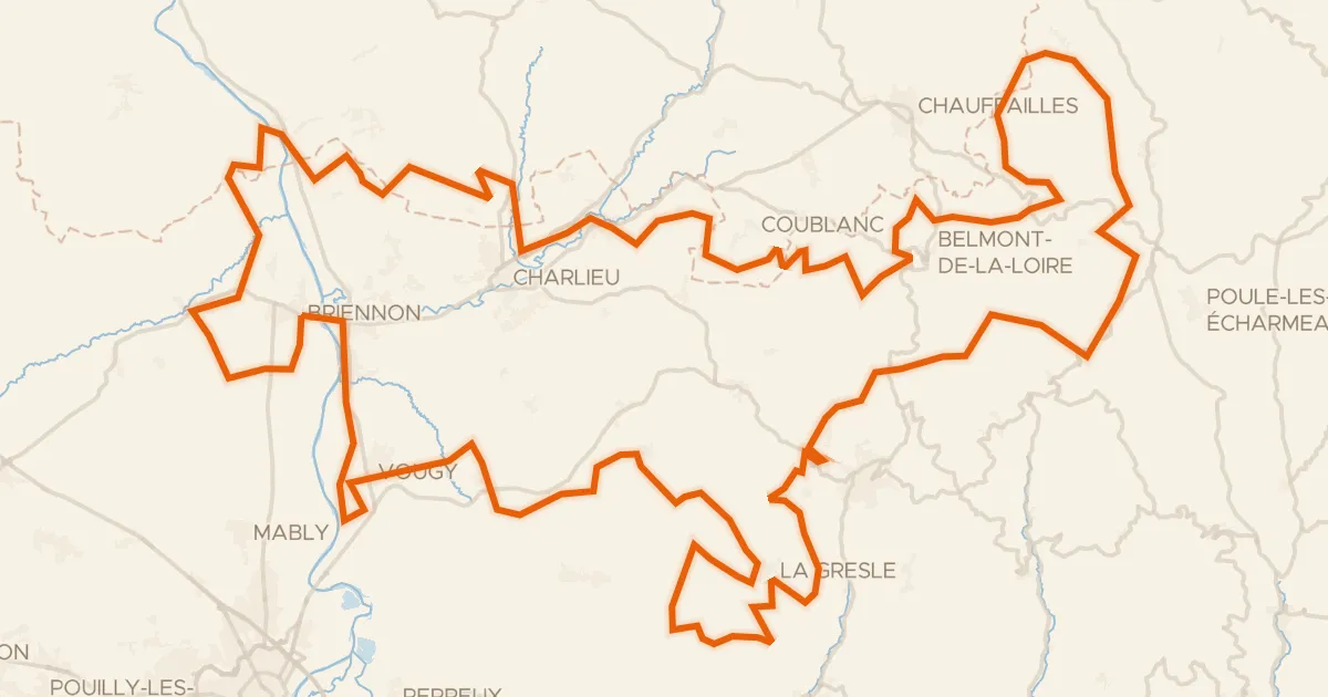
Rondje Château Saint-Hugues en La Loire
Distance
61 km
Ascent
855 m
Highest point
499 m
46% paved
Start from your location
Ride there from home: we find the shortest way to the loop and start the loop from there.
The ride
Roll out of Melay and follow the water: past the La Teyssonne river, then the La Loire, and on to the Sornin. Two castles break up the riding, the Château de la Garde and Château Saint-Hugues, before the L'Arçon river brings you home. It's 61.4 km with 855 m of climbing, split between paved and unpaved going. A lively loop that keeps unfolding from start to finish.
Climbs
Climb 1Hill
0.7 km at 5% · max 9.8%
Climb 2Hill
0.5 km at 5% · max 9.5%
Climb 3Cat. 4
1.5 km at 5.8% · max 10.6%
Climb 4Hill
0.7 km at 4.3% · max 9.1%
Climb 5Hill
0.8 km at 3.6% · max 9.5%
Climb 6Cat. 4
0.9 km at 10.1% · max 16.5%
Climb 7Hill
0.6 km at 6.7% · max 12.3%
Climb 8Hill
0.8 km at 7.2% · max 24.9%
Climb 9Hill
0.8 km at 7.6% · max 17.7%
Routes nearby

Road bike99% paved
Rondje Château de la Madeleine en La Loire
72 km↑ 612 m10 km away

Gravel27% paved
Rondje Château de Champagny en La Teyssonne
56 km↑ 1,058 m12 km away

Road bike100% paved
Rondje Château des Hormières en Le Renaison
79 km↑ 1,436 m19 km away
Gravel51% paved
Le Grand Tour du territoire
180 km↑ 4,355 m19 km away
Col des Écorbans · Col de Aillets

Gravel36% paved
Rondje Château de Beaulieu en La Loire
59 km↑ 1,243 m20 km away

Gravel45% paved
Rondje Château de Vougy en La Loire
61 km↑ 1,057 m21 km away