Back to the librarykm 1–12km 16–16km 19–20km 21–22km 62–65
Road bikeMade by RouteCasterRound trip
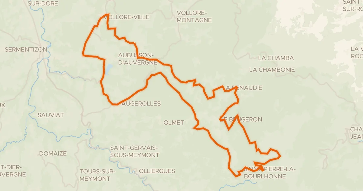
Rondje La Chaméane en L'Eau Mère
Distance
71 km
Ascent
1,177 m
Highest point
1,064 m
96% paved
Start from your location
Ride there from home: we find the shortest way to the loop and start the loop from there.
The ride
Roll out of Cunlhat and let the ride carry you past the river L'Astrou, then on to L'Eau Mère, another river along the way. La Chaméane, a third river, marks the turn for home. With 70.7 km under your wheels and 1177 m of climbing, it's a loop that keeps giving, and it brings you right back to where you started.
Climbs
Climb 1Cat. 2
11.7 km at 3.3% · max 16.1%
Climb 2Hill
0.7 km at 4.4% · max 7.9%
Climb 3Hill
1.8 km at 3.2% · max 10.2%
Climb 4Hill
1 km at 3.7% · max 16.4%
Climb 5Cat. 4
3.2 km at 4.2% · max 12.6%
Routes nearby
Road bike100% paved
Circuit du Forez - Les Hautes-Chaumes
72 km↑ 1,574 m14 km away
Col du Béal · Pas de la Croix

Road bike100% paved
Rondje Château des Rioux en La Dore
81 km↑ 954 m20 km away

Gravel18% paved
Rondje Château de Mons en La Dore
60 km↑ 1,594 m21 km away

Gravel15% paved
Rondje La Vêtre en Parc naturel régional Livradois-Forez
56 km↑ 1,686 m24 km away

Gravel14% paved
Langs de L'Auzon en Parc naturel régional Livradois-Forez
59 km↑ 1,922 m26 km away

Road bike100% paved
Rondje Château de Vollore en La Dore
97 km↑ 1,976 m26 km away