Back to the librarykm 0–4km 4–5km 5–15km 22–22km 23–24km 26–28km 32–33km 35–36km 36–37km 37–41km 47–50km 52–55
GravelMade by RouteCasterRound trip
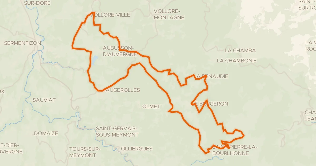
Rondje La Vêtre en Parc naturel régional Livradois-Forez
Distance
56 km
Ascent
1,686 m
Highest point
1,268 m
15% paved
Start from your location
Ride there from home: we find the shortest way to the loop and start the loop from there.
The ride
Roll out of Saint-Didier-sur-Rochefort and let the climbing begin: 1686 m of elevation gain awaits across 56.0 km. Most of it runs unpaved, so expect a mixed day under your wheels as you head into the Livradois-Forez nature reserve. Further on the route follows the La Vêtre river before turning back toward the village where you started.
Climbs
Climb 1Cat. 3
3.2 km at 5% · max 17.2%
Climb 2Hill
0.7 km at 8.7% · max 16.8%
Climb 3Cat. 2
9.7 km at 4.3% · max 24.3%
Climb 4Cat. 4
0.8 km at 13% · max 21.8%
Climb 5Hill
0.9 km at 4.4% · max 12.4%
Climb 6Cat. 3
1.4 km at 11.9% · max 27.8%
Climb 7Hill
0.7 km at 4.2% · max 10.4%
Climb 8Hill
0.5 km at 9.1% · max 14.8%
Climb 9Hill
0.6 km at 5.5% · max 10.9%
Climb 10Cat. 3
3.6 km at 7.2% · max 21.2%
Climb 11Cat. 4
2.4 km at 3.5% · max 13.8%
Climb 12Cat. 3
2.2 km at 7.5% · max 21.8%
Routes nearby

Road bike100% paved
Rondje Château de Couzan en Le Lignon
76 km↑ 1,326 m6 km away

Road bike100% paved
Rondje Château de Vollore en La Dore
97 km↑ 1,976 m13 km away
Road bike100% paved
Circuit du Forez - Les Hautes-Chaumes
72 km↑ 1,574 m14 km away
Col du Béal · Pas de la Croix

Road bike100% paved
Rondje Château de Ferrières en La Credogne
80 km↑ 1,650 m20 km away

Road bike100% paved
Rondje Château de La Roche en Lac de Villerest
73 km↑ 1,117 m26 km away

Road bike100% paved
Rondje Château de Sainte-Colombe en La Loire
76 km↑ 829 m27 km away