Back to the librarykm 2 · Mar 2024 · © gzin / Mapillary, CC BY-SA km 39 · Sep 2021 · © gzin / Mapillary, CC BY-SA km 60 · Oct 2019 · © gzin / Mapillary, CC BY-SA km 63 · Oct 2019 · © gzin / Mapillary, CC BY-SA km 43–46km 48–49km 58–62km 65–74km 76–77
Road bikeMade by RouteCasterRound trip
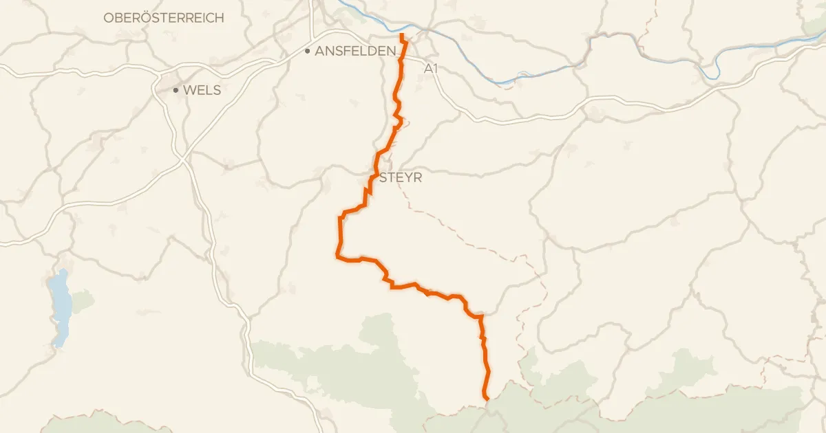
Castles between Krems and Steyr
Distance
82 km
Ascent
1,239 m
Highest point
786 m
100% paved
Start from your location
Ride there from home: we find the shortest way to the loop and start the loop from there.
The ride
Roll out of Kirchdorf an der Krems and follow the Krems river before the route climbs toward Schloss Achleiten and Schloss Sierning, two castles on the way. The 82.0 km loop keeps climbing to 1239 m of elevation gain, then drops to the Steyr and Enns rivers. A small unpaved share mixes in with the paved roads. Back to where you started.
Along the way
Climbs
Climb 1Cat. 4
2.6 km at 4.1% · max 9.5%
Climb 2Hill
1 km at 4.6% · max 16.3%
Climb 3Cat. 3
3.6 km at 5.3% · max 12%
Climb 4Cat. 2
9.1 km at 4.8% · max 20.8%
Climb 5Hill
0.7 km at 4% · max 9.6%
Routes nearby

Road bike99% paved
Hills between Krems and Steyr
77 km↑ 956 m6 km away

Road bike98% paved
Castles along the Krems
84 km↑ 869 m17 km away

Road bike100% paved
Waterside route between Enns and Reichramingbach
74 km↑ 1,333 m27 km away
Road bike96% paved
Ennstalweg (Oberösterreich)
92 km↑ 1,378 m30 km away

Road bike99% paved
Waterside ride from Asten to St. Florian
85 km↑ 825 m30 km away

Gravel64% paved
Castles between Haag and Kronstorf
63 km↑ 830 m33 km away