Back to the librarykm 0–3km 3–3km 4–5km 6–7km 10–12km 14–14km 15–17km 17–19km 19–20km 21–23km 25–26km 26–27km 32–34km 34–35km 36–37km 40–43km 46–48km 50–57
GravelMade by RouteCasterRound trip
Rondje Fortezza Pia en Fiume Tronto
Distance
60 km
Ascent
2,366 m
Highest point
1,002 m
46% paved
Start from your location
Ride there from home: we find the shortest way to the loop and start the loop from there.
The ride
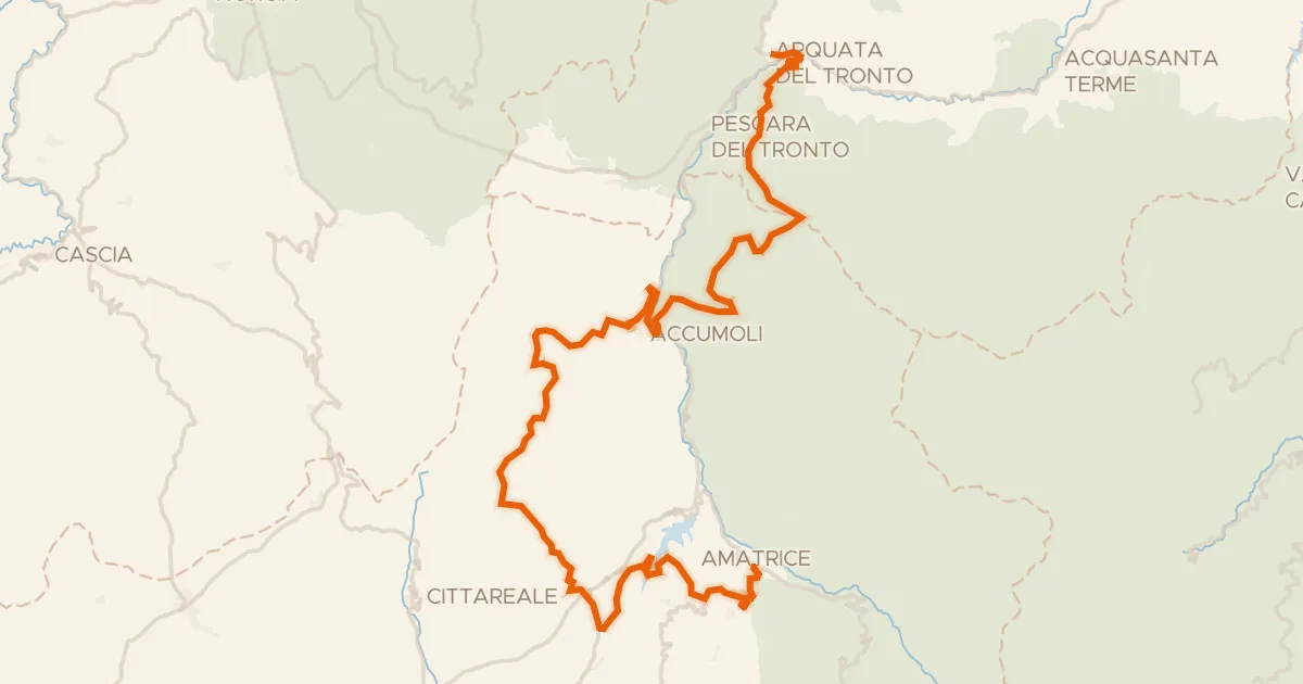
Roll out of Mozzano and the ride opens along the Fiume Tronto before climbing past Casalena castle. Next comes the Monte dell'Ascensione nature reserve, then Forte Malatesta castle and the Palazzo dei Capitani del Popolo. With 2366 m of climbing over 60.1 km, the legs will know about it, and the mix of paved and unpaved keeps things varied. Back to Mozzano to finish.
Climbs
Climb 1Cat. 3
2.3 km at 9.6% · max 35.2%
Climb 2Hill
0.4 km at 16.5% · max 31.6%
Climb 3Cat. 4
1.1 km at 7.5% · max 15.2%
Climb 4Hill
0.7 km at 11.1% · max 37.7%
Climb 5Cat. 4
1.7 km at 8.3% · max 21.3%
Climb 6Hill
0.7 km at 6.2% · max 21.4%
Climb 7Cat. 3
1.9 km at 10.3% · max 20.4%
Climb 8Cat. 4
1.9 km at 8.2% · max 20.8%
Climb 9Hill
1 km at 8% · max 19.3%
Climb 10Cat. 2
2.1 km at 17% · max 40.5%
Climb 11Cat. 4
1.2 km at 6.9% · max 26.8%
Climb 12Cat. 4
1 km at 10.5% · max 24.8%
Climb 13Cat. 4
2 km at 4.7% · max 14.5%
Climb 14Hill
0.9 km at 4.1% · max 10.1%
Climb 15Hill
0.7 km at 5.5% · max 7.9%
Climb 16Cat. 4
3.9 km at 3.5% · max 13.6%
Climb 17Cat. 4
2.2 km at 3.9% · max 23.9%
Climb 18Cat. 3
7.2 km at 4.3% · max 26.3%
Routes nearby

Road bike100% paved
Rondje Fortezza Pia en Lago di Talvacchia
80 km↑ 1,878 m9 km away

Gravel7% paved
Rondje Rocca en Monte Ceresa
59 km↑ 2,758 m13 km away

Road bike100% paved
Rondje Monte dell'Ascensione en Tesino
80 km↑ 1,351 m21 km away

Road bike96% paved
Rondje Torre Guelfa en Tesino
77 km↑ 957 m23 km away
Road bike98% paved
ABT Tappa 16: Arquata del Tronto - Amatrice
63 km↑ 1,856 m26 km away
Passo della Torrita

Road bike97% paved
Langs de Tesino en de Fiume Aso
75 km↑ 1,719 m29 km away