Back to the library
Road bikeMade by RouteCasterRound trip
Rondje Château Gaillard en Forêt de Chaux
Distance
74 km
Ascent
356 m
Highest point
325 m
100% paved
Start from your location
Ride there from home: we find the shortest way to the loop and start the loop from there.
The ride
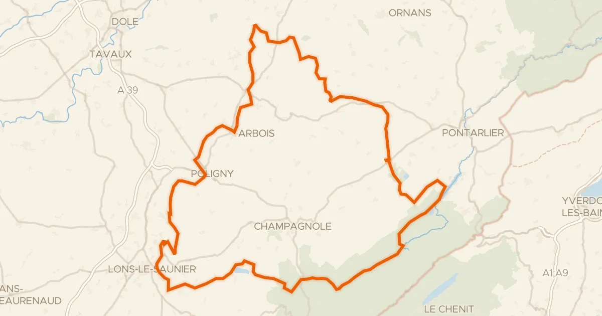
From Tassenières you roll out past the river L'Orain, with Château Gaillard castle and the La Loue river following in turn. Then the Forêt de Chaux woods take over before the La Cuisance river leads you home. It's 74.2 km of paved riding with 356 m of climbing, and it ends right back in Tassenières.
Routes nearby

Gravel60% paved
Rondje La Seille en La Brenne
59 km↑ 375 m21 km away

Road bike99% paved
Rondje Château d'Arlay en La Seille
74 km↑ 800 m28 km away

Road bike99% paved
Rondje Château de Montrambert en Forêt de Chaux
75 km↑ 622 m29 km away

Gravel23% paved
Rondje La Loue en La Furieuse
62 km↑ 1,615 m29 km away

Road bike100% paved
Langs de Reculée de Balerne en de Forêt de la Joux
76 km↑ 748 m32 km away
Touring94% paved
P’tite GTJ à vélo
256 km↑ 3,859 m33 km away