Back to the librarykm 1–11km 11–12km 22–24km 26–27km 47–51km 55–57
GravelMade by RouteCasterRound trip
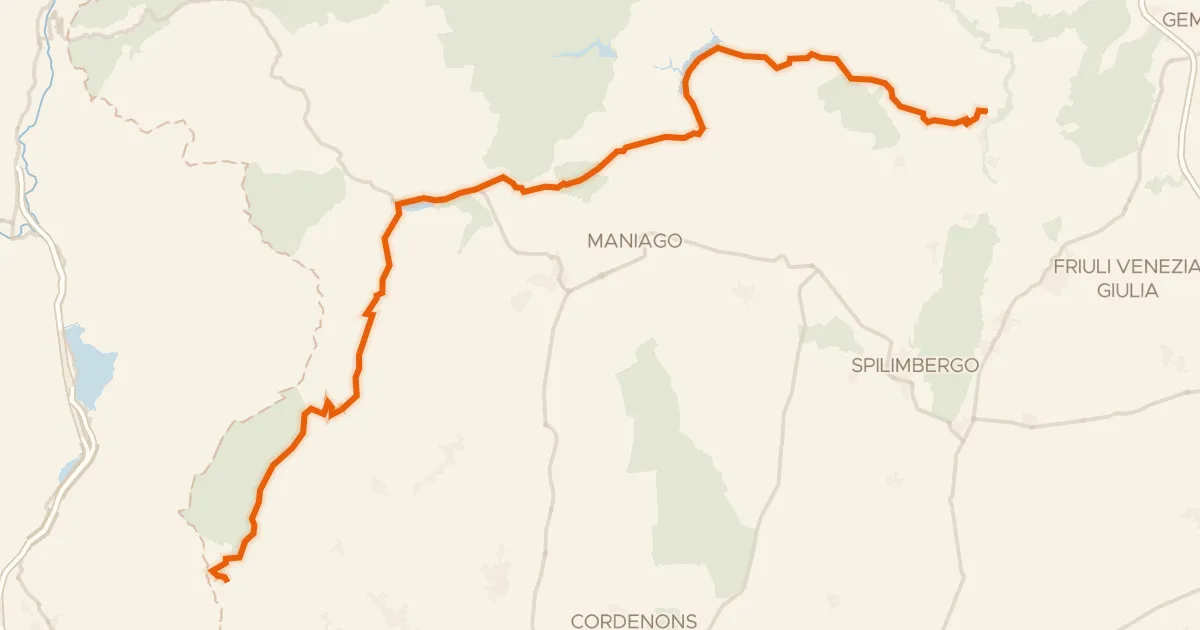
Langs de Torrente Cellina en het Lago di Barcis
Distance
58 km
Ascent
2,203 m
Highest point
1,446 m
12% paved
Start from your location
Ride there from home: we find the shortest way to the loop and start the loop from there.
The ride
This ride sets off from the parking area at the Forra del Cellina nature reserve and rolls out past Lago di Barcis, a lake, before following the Torrente Cellina river. The route covers 58.3 km, with most of it unpaved, and climbs a total of 2203 m of elevation gain. It loops back to where it began, at the same parking area by the reserve.
Climbs
Climb 1HC
9.7 km at 10.9% · max 40.3%
Climb 2Hill
0.6 km at 4.9% · max 17.8%
Climb 3Cat. 4
1.6 km at 7.5% · max 18.9%
Climb 4Hill
1.4 km at 3.7% · max 10.7%
Forca de la CrousCat. 2
3.6 km at 12.5% · max 31.2%
Climb 6Cat. 4
2 km at 4.9% · max 22.4%
Routes nearby
Touring72% paved
Montanevie - Itinerario turistico nel Friuli occidentale
91 km↑ 2,800 m11 km away
Forcella di Pala Barzana · Forca de la Crous

Gravel20% paved
Rondje Fiume Meduna en Torrente Cosa
62 km↑ 2,659 m21 km away

Gravel12% paved
Langs de Fiume Meduna en de Torrente Cellina
62 km↑ 215 m24 km away

Road bike99% paved
Rondje Fiume Noncello en Fiume Meduna
72 km↑ 191 m24 km away

Road bike100% paved
Rondje Fiume Noncello en Fiume Livenza
78 km↑ 217 m31 km away

Gravel40% paved
Langs de Fiume Meschio en de Fiume Monticano
58 km↑ 1,555 m33 km away